Monthly Archives: June 2013

Bicycling Gifford Pinchot National Forest

Can’t get lost if I don’t leave the road

Getting lost takes a while, and the seeds sewn into those misadventures usually happen long before one realizes ventures have gone awry.

Let me start out by saying: complacency can be a killer. After lacing up the new Marathon Mondials spinning them around the city, I was ready for a challenge. After all, I just got back from a disappointing adventure which never challenged me physically. I needed a challenge. Perhaps a one day ride heading east into the foothills of the Cascade Mountains, on the west side of the famous Columbia River Gorge, would quench my desire for a challenging ride. A fifty plus mile bicycle ride that offers challenging sandy trails, smooth asphalt, annoying chip-seal, and rocky forest service roads, all combined with over 4,500 feet of elevation gain. Thirty out of fifty miles of this ride are predominately flat. After searching my neighborhood for some great bicycling roads that I haven’t already discovered, (which are scarce – where haven’t I pedaled to) I decided on a route posted on a well-known local bicycling shop’s blog. How could things go wrong?
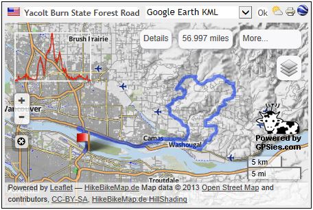
Ride Map Overview

I made my first mistake straight out of the shoot by not bringing enough water with me. I had no real knowledge of how long this ride would be. The second mistake made was by-passing every single store on the way to the national forest service road having never stopped to grab more water. When I reached the turning point to head south into the mountains, I was halfway through my water supply.

The third mistake made, which was basically being strike three; I depended upon using my iPhone as a GPS map. I used an application which saves a downloaded map of your chosen area. This map then displays your current location via PGS signal on the preloaded map. No cellular service is required. And in this section of Washington State inside the Gifford Pinchot National Forest (and just outside the boundary as well), there is no cellular phone coverage.

Being that I had complete faith in my iPhone, map reading, bicycling ability, and wilderness survival skills, I really didn’t need to take enough water for my unknown length of adventure, right? Wrong!

I’ve spent a fair share of time out in the wilderness. One of the things I’ve always done before heading out on an adventure into wilderness situations was to prepare for the worst, and hope for the best. Prior to my rebirth, and back in my twenties when I was car camping and partying, I would take off on adventures without preparing, or respecting situations. This could be construed as one of those times. And no person would ever think that they might actually get lost forcing themselves into survival situations. That only happens to inexperienced hikers, bikers, campers, or those stupid enough to place their own selves at risk, yes? Nope.
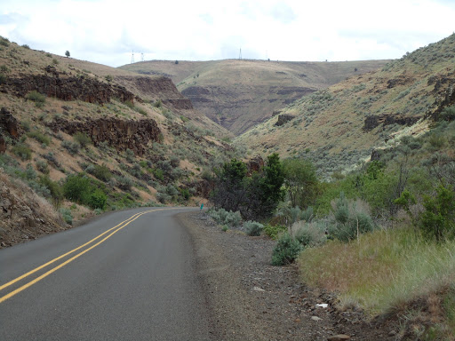
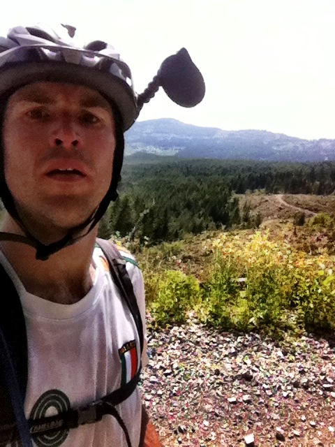
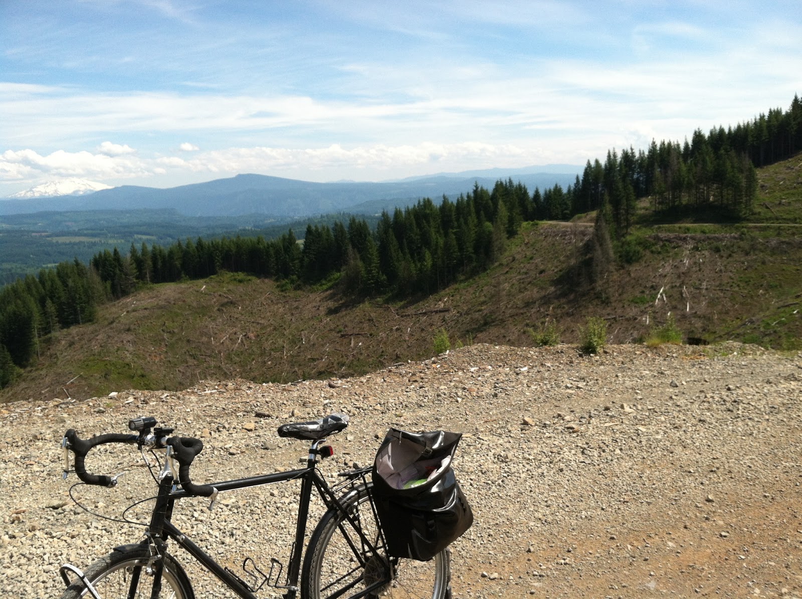
Road Traveled

These were the directions I had, verbatim:

-Enter Yacolt Burn State Forest Road (GRAVEL)

-There is limited or no signage on this road. Like all roads and directions, YOU are responsible for navigating your way. Detailed maps are available from local bike shops, and GPS will earn its keep here. Once reaching the top of a long section of climbing after a few miles, the road forks. To the right it continues to climb. To the left is begins to descend. Begin descending to the Left. (sic)

-After a considerable amount of descending, the road will fork again. As a reference, to the left, you may see a yellow gate. Proceed to your Right. As a reference, you will soon pass a parking lot.

-Exit Yacolt Burn State Forest Road onto pavement at Boulder Creek Road.

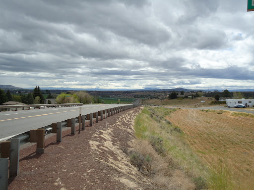
The correct turn – what i didn’t think was a “Fork”
I guess my problem is that I read words typed on a page meaning the literal sense of said printed word. If you were to tell me a fork would have one choice, then I’d disagree. A road having a simple turn off, well then I’d say take a left at your first opportunity. That’s not an actual “fork in the road,” is it? This is.
What I thought was, the “Fork”

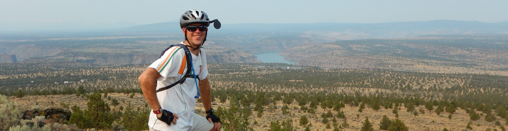
Misadventures come from poor planning, lack of available failsafe’s, and perhaps that desire to fulfill the sense that, “this really can’t be happening to me.” Because of this, one pushes further on because that trail that was lost is just around the next corner. Once I found myself on the forest road without enough water to be comfortable, I became nervous. Once I realized I was heading the wrong direction I turned back. I was amazed at how I could have put myself into a dangerous situation without enough supplies. I was short on water; I was using an iPhone as a GPS comparing my location on said map with shoddy directions.

On the wrong road

I’m truly amazed at how I became so confident in my abilities that I lacked the good judgment to fully prepare for going into an extreme environment. The wilderness doesn’t care whether you live or die. I’m glad I was wise enough to turn back the way I came instead of pushing onward. I was completely off track. I should have taken the first left.

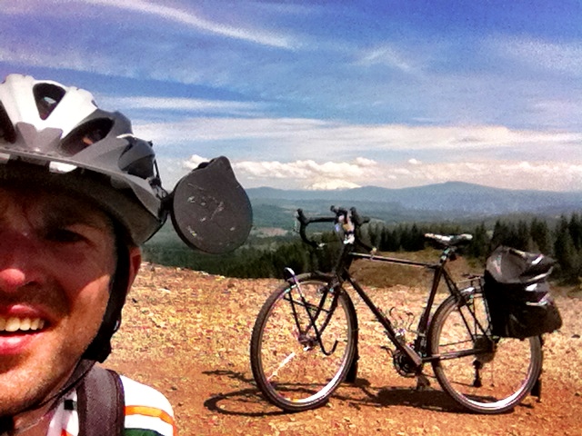
Few Supplies this time around

Yosemite’s End Game


Six months of planning, watching the weather, reading snow reports, following highway openings, crossing “T’s” and dotting my “i’s” – none of that matters when I can’t control the weather.
Before I left on my journey to Yosemite National Park, the weather in Central Oregon was 85-90 degrees.  I was watching the weather closely when I decided to leave a week early because a cool-down was forecasted for the region.  The weather was predicted to be in the mid 60’s in Central Oregon.  I chose to leave so I wouldn’t be submerged into suffocating 90 degree weather, in the shade, after nine months of cycling in 50 degree rainy weather.
With all my planning, I couldn’t predict that a large low pressure system would drop out of the Gulf of Alaska planting itself on top of the Pacific Northwest while I was cycling to Yosemite.  The low pressure system would make riding difficult by lower snow levels, kicking-up Southwesterly winds, and bringing dangerous crosswinds all while forcing me to stay out of my planned mountain route, thereby keeping me on US Highway 97.  
Looking Down Upon Madras

 I’ve previously used Oregon State’s published Bicycle Map finding it to be accurate.  Because of this, I placed a good deal of trust in said map which allowed me to deviate from my planned route, if circumstances forced me to do so.  One never knows what conditions may arise on these journeys, such as: poor road or trails, and maybe bad weather.  The Oregon State Bicycling Map offers information detailing main highways with stats such as: summit passes, and most importantly shoulder width on the main highways.  This time though, I found the maps shoulder data of US Highway 97 very misleading.  Most importantly, the first 140 miles stated to have a shoulder of two to four feet.  It doesn’t.  The first 140 miles (Klamath Falls region) of US Highway 97 has an average shoulder width of 2 feet, or less.
  

Snow Storm in La Pine, Oregon

Reaching Klamath Falls by pedaling south on Highway 97 from Madras was a very spine-tingling feat.  On more than one occasion I was forced to leave the shoulder ditching the bike (and myself) into the soft gravel culvert.  My eye was continually fixated onto my review mirror watching, and hoping, the traffic would drive around me.  This southerly riding was made all the more challenging with a wind racing northeasterly, blowing out of the southwest, effectively pushing me into the middle of Highway 97 where cars, jacked-up pickups, buses, RVs, and large noisy semi-tractor-trailers, would pass me by at 60 MPH; sometimes only leaving me with a cushion of 6 inches.  And that wasn’t the scary part of the highway.  What’s worse is when two oncoming vehicles are taking up both lanes of the highway…
My decision to abandon my trip was made suddenly on the 26th of May 2013.  I took the back roads out of Klamath Falls, Oregon, meeting highway 97 approximately 11 miles south of the city center of Klamath Falls.  Pedaling to meet up with the highway was a cold process riding directly into the winds that were racing out of the Southwest.  The days forecast was for 15-25 MPH Winds with gusts into the 40’s.  Again, the weather forecast was accurate.  When I came upon the highway, turning southerly, I could see the storms off in the distance.  With the winds, low traffic on the highway (Sunday of Memorial Day Weekend), and the high winds trying to push me into traffic, my decision to abandon the journey wasn’t a hard decision to come to. 
Killing Time wearing two coats cause it’s cold
406 miles of a 750 mile trip to Yosemite had been completed as of that Sunday.  None of those 406 miles had been originally planned and routed.  Riding up Mt. Bachelor would find me traversing through high winds, rain, snow, and sleet.  And now I was coming upon Mount Shasta, where much of the same weather was on order.  When I came upon the intersection of Highway 97 south of Klamath Falls, I perceived the end.
There was a bend in the highway which was a dogleg to the left that rose and then fell away after the turn which created a blind corner with impaired sight distance.  The traffic was light that day, although the semi-truck traffic appeared to be one truck per every thirty seconds, on average.  I sat at the side of the road counting the trucks.  I was nervous because the dogleg had a shoulder of no more than six inches coupled with high winds pushing me into the road.  Not only that, the dogleg shoulder led to a drop-off into a culvert about five feet deep leaving me with no options to bailout should a truck race around the corner.
This situation had me nervous.  If traffic were heavy I would have just forced myself onto the shoulder making myself visible to traffic, and thereby forcing them to swerve around me.  But, being that there wasn’t traffic, and the only traffic on the highway at 8:00amwas commercial truckers, I felt very nervous about negotiating this dogleg.  It wouldn’t take much for a trucker to drive through this dogleg corner with impaired sight distance coming up behind me and ending my life.  With no traffic on a Sunday morning, and bad weather, who’d think a cyclist would be pedaling south towards Mt Shasta with a forecast of snow, high winds, thunderstorms, and cold temperatures?  I wasn’t about to tempt fate.  I turned around heading back to where I came from.
Storms awaiting me south of K Falls.  End Game!
I stopped at a rest-stop on Highway 97 and consulted my maps.  The only way around was for me to head east and cycle clear around Mt Shasta meeting CA. HWY 89 South of Mt Shasta, California.  This route would force me well above the snow level which was hovering around 4,000 to 5,000 feet.  My bypassing of the last 75 miles from Klamath Falls to Weed would have me cycling mountain passes at 7,000 feet.  That wasn’t happening… I had to abandon my journey.
I rented a car and safely drove home.