Author Archives: Tim_Normal_Guy

Unknown's avatar

About Tim_Normal_Guy

Tim Campbell, a heart disease survivor, has survived two heart attacks and a life-saving emergent quintuple by-pass open heart surgery. He was thirty-one at the time. Since then, he’s lost over one hundred pounds changing his entire life in the process.

Yosemite’s End Game


Six months of planning, watching the weather, reading snow reports, following highway openings, crossing “T’s” and dotting my “i’s” – none of that matters when I can’t control the weather.
Before I left on my journey to Yosemite National Park, the weather in Central Oregon was 85-90 degrees.  I was watching the weather closely when I decided to leave a week early because a cool-down was forecasted for the region.  The weather was predicted to be in the mid 60’s in Central Oregon.  I chose to leave so I wouldn’t be submerged into suffocating 90 degree weather, in the shade, after nine months of cycling in 50 degree rainy weather.
With all my planning, I couldn’t predict that a large low pressure system would drop out of the Gulf of Alaska planting itself on top of the Pacific Northwest while I was cycling to Yosemite.  The low pressure system would make riding difficult by lower snow levels, kicking-up Southwesterly winds, and bringing dangerous crosswinds all while forcing me to stay out of my planned mountain route, thereby keeping me on US Highway 97.  
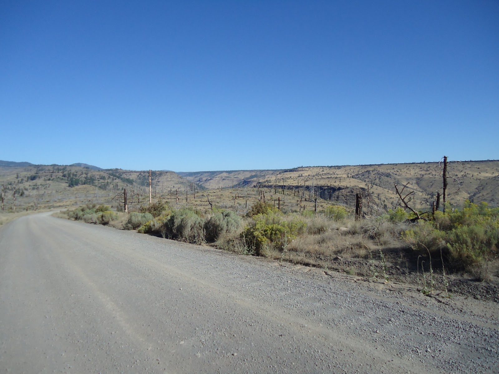
Looking Down Upon Madras

 I’ve previously used Oregon State’s published Bicycle Map finding it to be accurate.  Because of this, I placed a good deal of trust in said map which allowed me to deviate from my planned route, if circumstances forced me to do so.  One never knows what conditions may arise on these journeys, such as: poor road or trails, and maybe bad weather.  The Oregon State Bicycling Map offers information detailing main highways with stats such as: summit passes, and most importantly shoulder width on the main highways.  This time though, I found the maps shoulder data of US Highway 97 very misleading.  Most importantly, the first 140 miles stated to have a shoulder of two to four feet.  It doesn’t.  The first 140 miles (Klamath Falls region) of US Highway 97 has an average shoulder width of 2 feet, or less.
  

Snow Storm in La Pine, Oregon

Reaching Klamath Falls by pedaling south on Highway 97 from Madras was a very spine-tingling feat.  On more than one occasion I was forced to leave the shoulder ditching the bike (and myself) into the soft gravel culvert.  My eye was continually fixated onto my review mirror watching, and hoping, the traffic would drive around me.  This southerly riding was made all the more challenging with a wind racing northeasterly, blowing out of the southwest, effectively pushing me into the middle of Highway 97 where cars, jacked-up pickups, buses, RVs, and large noisy semi-tractor-trailers, would pass me by at 60 MPH; sometimes only leaving me with a cushion of 6 inches.  And that wasn’t the scary part of the highway.  What’s worse is when two oncoming vehicles are taking up both lanes of the highway…
My decision to abandon my trip was made suddenly on the 26th of May 2013.  I took the back roads out of Klamath Falls, Oregon, meeting highway 97 approximately 11 miles south of the city center of Klamath Falls.  Pedaling to meet up with the highway was a cold process riding directly into the winds that were racing out of the Southwest.  The days forecast was for 15-25 MPH Winds with gusts into the 40’s.  Again, the weather forecast was accurate.  When I came upon the highway, turning southerly, I could see the storms off in the distance.  With the winds, low traffic on the highway (Sunday of Memorial Day Weekend), and the high winds trying to push me into traffic, my decision to abandon the journey wasn’t a hard decision to come to. 
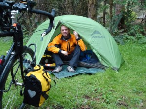
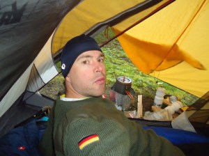
Killing Time wearing two coats cause it’s cold
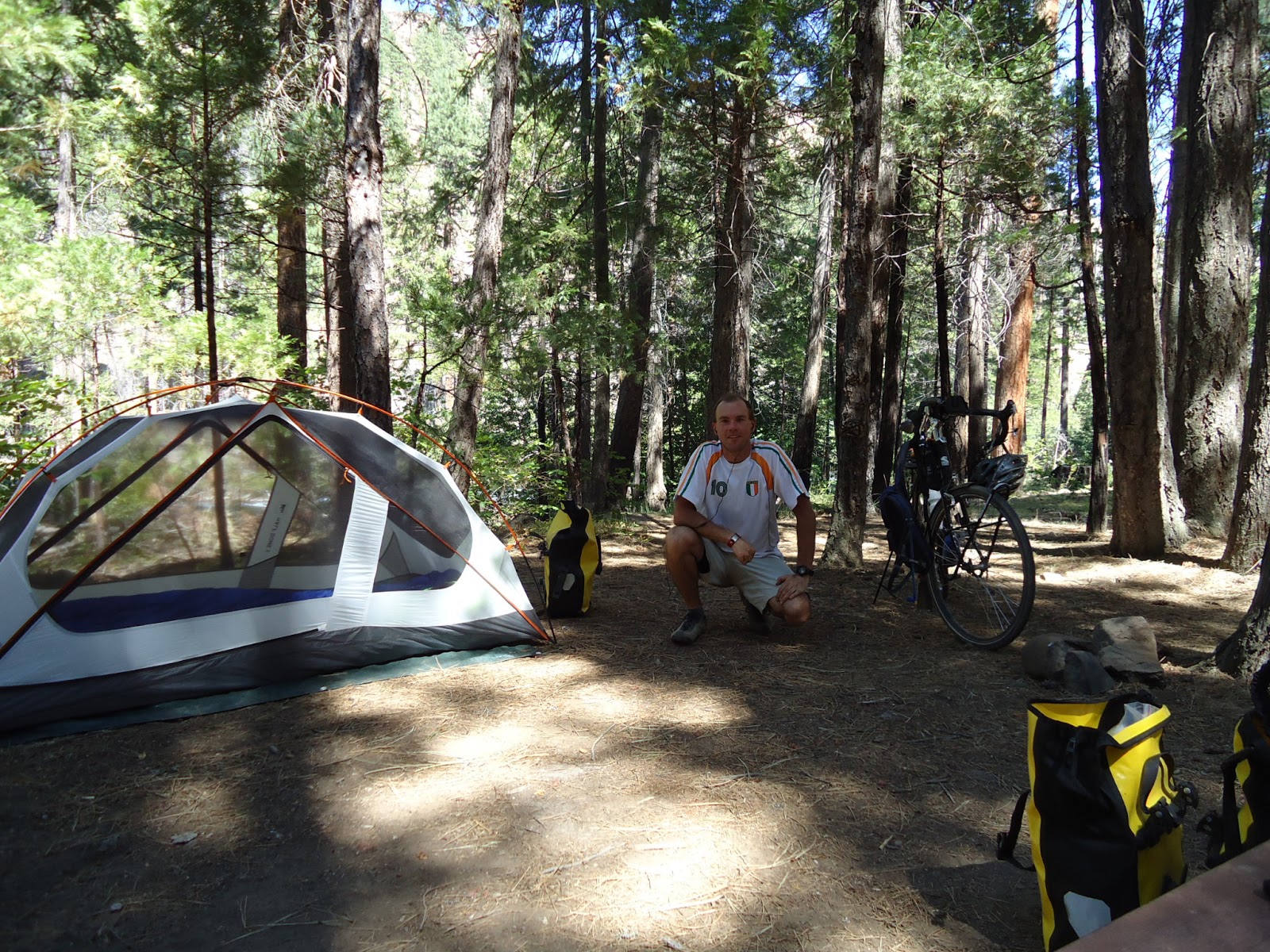
406 miles of a 750 mile trip to Yosemite had been completed as of that Sunday.  None of those 406 miles had been originally planned and routed.  Riding up Mt. Bachelor would find me traversing through high winds, rain, snow, and sleet.  And now I was coming upon Mount Shasta, where much of the same weather was on order.  When I came upon the intersection of Highway 97 south of Klamath Falls, I perceived the end.
There was a bend in the highway which was a dogleg to the left that rose and then fell away after the turn which created a blind corner with impaired sight distance.  The traffic was light that day, although the semi-truck traffic appeared to be one truck per every thirty seconds, on average.  I sat at the side of the road counting the trucks.  I was nervous because the dogleg had a shoulder of no more than six inches coupled with high winds pushing me into the road.  Not only that, the dogleg shoulder led to a drop-off into a culvert about five feet deep leaving me with no options to bailout should a truck race around the corner.
This situation had me nervous.  If traffic were heavy I would have just forced myself onto the shoulder making myself visible to traffic, and thereby forcing them to swerve around me.  But, being that there wasn’t traffic, and the only traffic on the highway at 8:00amwas commercial truckers, I felt very nervous about negotiating this dogleg.  It wouldn’t take much for a trucker to drive through this dogleg corner with impaired sight distance coming up behind me and ending my life.  With no traffic on a Sunday morning, and bad weather, who’d think a cyclist would be pedaling south towards Mt Shasta with a forecast of snow, high winds, thunderstorms, and cold temperatures?  I wasn’t about to tempt fate.  I turned around heading back to where I came from.
Storms awaiting me south of K Falls.  End Game!
I stopped at a rest-stop on Highway 97 and consulted my maps.  The only way around was for me to head east and cycle clear around Mt Shasta meeting CA. HWY 89 South of Mt Shasta, California.  This route would force me well above the snow level which was hovering around 4,000 to 5,000 feet.  My bypassing of the last 75 miles from Klamath Falls to Weed would have me cycling mountain passes at 7,000 feet.  That wasn’t happening… I had to abandon my journey.
I rented a car and safely drove home. 

A Date With A Storm

Seven in the morning came all to early yet i was eager to move on. Time to wake up and pack. As I finished packing I closed the garage door and noticed my host standing at the door ready for us to head to breakfast. 

We went to breakfast at Jakes Diner. I had my usual power breakfast consisting of eggs hash-browns toast and flapjacks. While chowing on breakfast I noticed an American Flag being tossed about in a decent wind. I thought as I sat in the restaurant that the flag was being blown from the north. When my host and I finished breakfast we walked outside and I soon discovered that the flag was being assaulted from the Southwest. Not good. 
The wind was relentless making the cycling tough all day. I took the back roads to Sunriver. I went south on Century Drive from Bend Oregon and then turned East on FS 42. The day was made exhausting by the hail sleet wind rain and cold temperatures. 
As I was nearing La Pine I could see the sky’s darkening. I kicked up my speed hoping to beat the impending storm to my intended destination. A motel room. 
The closer I got to La Pine so to were the storm clouds. I was coming up to a BiMart when the sky’s opened up and the winds howled. A gust of wind violently shoved my bike around like a ping pong ball in a wind tunnel. 
I quickly turned into the parking lot of the BiMart racing towards the covered entrance of the building. There I stood waiting out the downpour. Five minutes later the sun came out and the rains stopped. Back on the side road and into La Pine I arrived at the intersection of Huntington Road and highway 97. Looking southward towards the sky I saw the storm. It had arrived in La Pine just as I had. 
Quickly I rushed to the Motel. The sign said “No Vacancy” but I was going to inquire anyhow. I parked my bike checked the door to the Motel office. Locked! I rang the night bell. No answer. Fuck!  The sky was still holding to the moisture but the winds were angry. I checked the next motel on my map geared up and headed to the South end of La Pine. Reaching the Motel the sign indicated vacancy. I parked my bike and headed inside as the sign on the door suggested. 
The office was empty and a sign on the desk said “Sorry No Vacancy.”  My heart sank instantaneously. Why did the sign out front say vacancy. There was just one Motel left in town. A Best Western expensive business class. I decided to ring the night bell as the note taped on the desk instructed. No response. Again I pushed the button. Still no response. I checked my map and located the best western and then it happened. The torrential rains came rushing out of the sky and the winds raced back towards Bend Oregon. 
I decided I needed to make contact with someone at the West View Motel so I looked up the number on my iPhone. I called the telephone number and score. “Hi my name is Tim. Your sign out front says you have vacancy and I’m inquiring as to staying the night.”  “Okay well I will have to check.”  “Okay good cause I’m in your lobby now.”  “You are!?”
A heavy set lady walks in from a sliding glass door that was curtained off from the opposite side of the lobby. After a few minutes of paper work and money exchange she hands me the room key and says, “Wow! It sure got nasty real quick, didn’t it.”  “Nope, things just got a lot better.”

Week 1 review

The first week of touring ends with me cycling out of Bend, OR. on day seven. My route took me from the North side of Vancouver into Portland then East via highway 30 to Cascade Locks. That first day brought me cold rains, and first day jitters. 
Day two, would offer pleasant cycling through the small town of Mosier, and on into The Dalles. In Mosier I met a cyclist who once pedaled from Florida to Seattle, Washington. 
Day three brought cold morning rains and a twenty mile ascent south to Maupin, where I would camp at an over priced county park. Oh, and the park was infested with little black bugs that reminded me of fleas! 
Day four brought cold down pours and cloudy sky’s all the way into Madras with some descents that included some wicked headwinds that challenged my bicycle handling skills. On this evening my knee would act up and cause severe doubts about the trip. Plus an awful nights rest due to some unpleasantness from teenage neighbors in the towns trashy Juniper Motel on highway 26. 
Day 5 would find me adjusting my bike in the morning. My stiff and sore knee would loosen up on the pleasant easy ride into Bend, Oregon along a dangerously busy highway 97. 
Day six, I’d wake up to a pain free knee. My adjustment appeared to work. And day six was a rest day. 
To end out the week on Day seven I head south through Sunriver, Oregon and will be camping east of Crescent. 
Picture taking during the first week was hampered by the weather. 

Black Magic Rides Again

Life can get real crazy, really fast. I’m ready to head out on my first big 2013 bike journey. These past few months have felt like a roller coaster ride straight into hell.

The shakedown ride was a success, all things considered. The weather didn’t cooperate – my knee was relatively pain free which equals success. The trip was supposed to be a four day adventure heading east on Oregon highway 224, beyond the little town of Estacada. The first night I camped at Milo McIver State Park. The second night I snuck into a closed campground and stealth-camped near the Carter Bridge, on Oregon highway 224.

Camp at Milo McIver

My plan was to head all the way to the end of Oregon 224 where it turns into Forest Service Road 46. Things didn’t go as planned because, and as I found out on the second day, all the campgrounds (with the exception of Milo McIver State park which is open year round) were still closed. Near the end of Oregon highway 224 is a little village named Ripplebrook, which has a campground where I planned on staying. Well, Ripplebrook has a very active USFS Ranger Station, and being that the campgrounds were still closed, there was no way I was going to try and stealth camp next to a very lively Ranger Station.

Stealth camp near Carter Bridge

On the second night, the skies opened up at 3:00am and the big faucet in the heavens didn’t shut off until I had pedaled my wet ass all the way back into Clackamas, Oregon.

That three day journey rendered my body exhausted. The three day adventure was relatively successful, all things considered. However, my body wasn’t quite up to the task. I’ve been dealing with some issues on the heart disease front. These issues are beginning to work themselves out though. And hopefully, as the departure date draws near my body will begin firing on all cylinders.

These issues stemming from heart disease have proven something far beyond a reasonable doubt. I am completely, and one hundred percent, healthy. I’ve now had a (April 30th) stress test, numerous EKGs, blood tests; and everything else under the sun at one time, or another, and they’ve all proven that I’m completely healthy. The issues seemed to have resolved themselves with the decision to discontinue with a recently prescribed medication, and I’m now sleeping regularly (which had been eluding me for approximately three months), and the PVCs have declined (which have also been plaguing me for three months) to an almost zero daily average.

So, as I begin to soak up the regular sleep while continuing to adjust the bicycle so as to conquer this crappy knee tension, my body should be ready to depart on an adventure that has taken way too long to arrive.

Yosemite, It’s about damn time!

The Adventures of Randonneuring

The sport of cycling, in America, isn’t even a blip on the radar screen when compared to football, basketball, baseball, and perhaps even soccer. The downfall of Lance Armstrong, one of America’s most iconic sports characters, has cast a spotlight on a sport few Americans understand. Some people even have an opinion on the troubles of this so called dirty sport that they fail to comprehend. And this is fine. People are free to judge as they so choose. That’s what makes America so great – Free Will.

What is this sport of bicycling? Why do people who like the sport think it’s so great? “I mean, come on, anyone can ride a bike.” I don’t know how many people have said that to me over the years. People have said this to me as well, “It’s a bike, it’s a toy, I had one when I was five.” I always reverse said statements made: Anybody can push down on a gas pedal, kick a ball, or swing a golf club. Yet, few can do those well. So what is it with my fascination of cycling, and why do I like it so much? Oh, and I’m not a racer; I’m a long distance cyclist.

The beautiful thing about cycling is that it’s played out on the open road, path, or trail. It hides nothing. There is no secret to how it’s done. Sure there is technique, gadgets, lingo, fashion, gimmicks, and technology involved. But at the end of the day, and when you strip everything away, it’s the rider, the road, and the bicycle. The road just is. It’s an inanimate object – it isn’t against you, nor is it for you; but it can make one suffer like no other. The rider feels the pull of the earth as he ascends a mountain. He also feels the earth pushing him faster and faster as he descends that same mountain. The end result being, the bicyclist forms an intimate knowledge of the road traveled. It’s the freedom involved in cycling, that free will to choose the road, path, or trail less traveled. And, of course, we cannot forget the amazing feeling of wind in the hair. The bicycle can become a time machine, reminding ourselves of when we were children at play. In its simplicity the bicycle is, Free Will.

But cycling is so much more. It’s my drug of choice. When the mind is clogged up with clutter from the chaos of life all I have to do is jump on Black Magic, and pedal down the road. As I gobble up miles the mind starts organizing the mess, and clearing pipes. My thoughts become sharper, my mood lightens, my stress is released, and life is much more enjoyable. If I could capture the euphoria of a really long bicycle ride placing it into a pill it might possibly become the most widely used drug. Then again, it might not.

There are challenges to really long bicycle rides. The person has to suffer. Riders have to keep their energy reserves high making sure the tank doesn’t go empty. When it does, and blood sugar drops from lack of calorie intake, the heart begins to take the good blood supply away from the brain delivering it to the muscles demanding the fresh blood. It’s called “bonking,” “hitting the wall,” “meeting the man with the hammer.” And, it’s always an interesting experience.

The highs of cycling are really high, and the lows, extremely low. I guess that’s why an adventure cyclist like me always looks for more challenging obstacles. Perhaps it’s the idea that the next high has to be more extreme than the last. That next rock climb has to be bigger and higher. The next car has to bigger and faster. As we advance we have to take on bigger and better. My next challenge is coming this May. And of course this next challenge is more extreme than the last.

The Essential Biker

What goes in those weird bags (panniers) that get strapped onto the bicycle? And, why would anyone want to pedal a bicycle for endlessly long hours just to have to set up camp, cook on a little stove, wear smelly clothes, be cold, and then get up and do it all over again the next day? Who in their right mind would want to strap on 60 pounds of gear and pedal up a mountain? Have you gone mad! Yep, it’s crazy fun!

The Gear

When I set out on bike-packing mission, or a long tour, the gear I take is the same. It doesn’t matter if my trip is a s24o, three days, or five months long. I take the same basic supplies. This list is an almost completely exhausted list, it gets trimmed down to fit the occasion.

Shelter and Sleeping Arrangements for One

Tent: REI Half-Dome two person tent.

Sleeping Bag: Marmot Pinnacle 15 degree.

Sleeping Bag Liner: Sea to Summit 15 degree light weight (this preserves the bag knocking up the temperature rating of the bag minus 15 degrees) liner. This essentially makes the Pinnacle a zero degree bag.

Sleeping Pad: I double up. I use a Z-Lite closed foam pad under my NeoAir Trekker inflatable pad. This set-up gives me ultimate comfort with less heat loss due to convection from the ground below. Not only that… during the days if I need to sit somewhere and want to keep my ass dry, or up off the ground, the Z-Lite gives me a seat.

Tarps: On long trips I carry two five by seven tarps. One is a ground cloth for my tent, the other is for whatever needs to be covered. Me on a rainy day; or perhaps, Black Magic if the night looks wet?

The items listed above all fit in the right rear pannier, called, the bedroom.

Survival Gear, i.e. cookware and etcetera.

Stove: MSR Dragonfly Stove, I like to cook real food. The dragonfly offers me the ability to do so. I do have a Primus Yellowstone canister stove that I use on ultra-light missions. However, canister cooking has it’s downfalls that make me less likely to use the Primus. The Yellowstone (for $20.00 you cannot go wrong) will fit into my back pocket though, and only has two parts.

Cookware: GSI Dualist pot, it is my cook everything pot. It’s the only pot I carry. Inside my pot I put a measuring cup, a bowl with which houses a few items, two lighters and matches, and pot-holder, and a rag.

MSR Miniworks EX water-filter: No self-respecting outdoorsman would go out without one. Simple, easy to use, clean, and field maintain.

Eating Utensil: Light-My-Fire spork, it’s titanium and has a serrated edge to cut with. Spatulas, mini sponge, camp-soap, and hand sanitizer.

MSR Pack-towels: Two full size, and one face cloth size. The face cloth size stays in my handlebar bag.

Magnesium Flint Stick.

Multitool: I carry the Leatherman Wave.

Various pieces of bike gear: Spoke-wrench, nuts, bolts, wire, etc..

Knife: A belt knife generally used for cooking, and a Benchmade that stays on my person (Rule #9).

Parachute Cord: I carry with me 50 feet of parachute cord, and clothesline for my kit to hang-dry.

Laundry soap: it’s generally carried unless I know I will be adventuring out into the wilderness.

MSR Dragonfly field repair kit: and a spare windscreen.

Heavy Duty tinfoil wrapped up in square sheet.

Camelback: 2 liter. I also carry a water bottle for the water filter, and two bicycle water bottles, and if I know I’m going without water resupply for a long while to no access of available water to filter; I bring along a gallon jug.

Toiletries.

The above listed fits into my left rear pannier, called the kitchen. Well everything except the Camelback, and that of course is worn on my person.

The Art of Dressing

Pants: One-hundred percent merino wool pantaloons, only one.

Shorts x2: The shorts have to be moisture wicking, quick drying, and water resistant.

Socks x3: Wool, wool, wool.

Sweater: Again, it’s got to be wool. Wool keeps eighty percent of its insulating value when soaking wet, and it doesn’t stink.

Shirts x3: Moisture wicking high-tech, and light weight.

Thermal Underwear: seasonal of course.

Flip-flops for the shower

Shoes: Cycling shoes that have the cleat built into the shoe, and they need to have some flexibility for hiking purposes. Light weight and quick drying is a must.

Some seasoned tourists may call this kit overkill, but hey, that’s my style. Plus I don’t like to look, and smell, like an old worn out shoe.

The aforementioned kit fits inside the closet, the right front pannier.

The Pantry:

I can fit up to 5 day supply of food. I carry spices, snack bars, and beef jerky when climbing mountains. I also prepare a home-made trail mix complete with dark chocolate. I always carry 2 freeze-dried dinners as emergency food.

The pantry is the left front pannier.

Upgrade to the list this year: MSR Hubba single-person tent, and maybe the gear shield.

Something Old – Something New


Remembering an old trip and training for anew.

Camp at Monty

Random thoughts while resting at Monty Campground, Deschutes National Forest – August 3, 2012.

I like this campground; it’s a beautiful setting.

Being healthy is awesome and it gives me the ability to do these things (traveling by bike).

My spelling sucks, and at times, so does my penmanship.

I checked the map and couldn’t find a surefire way of getting to Sisters through the Metolius Scenic River area. Eddie Vedder’s Long Nights is playing. Love Into the Wild. Christopher McCandless and I would have been good friends, I think. We both obviously cherish our wild places. I wish I could have met him.

If I had my guitar I would be practicing with it right now.

My bike had a crash today as I was removing my panniers from the racks. The bike fell on its side breaking my mirror. Not the mirror itself, but the clip that mounts it to the handlebars essentially breaking the usage of said mirror.

A view from the saddle (mirror)

 The future is bright.  Musings from the open road begins.  Remodeling is almost complete.